Highway 50 Trails
Learn more about the HWY 50 CorridorHighway 50 Corridor
Placerville Ranger District
Bryan Meadows
From Highway 50 turn onto the Sierra-At-Tahoe Road (approximately 48 miles east of Placerville) and continue for 2 miles turning right onto Bryan Road (17E13). It is 2 1⁄2 miles to the parking area located at the Sayles Canyon/ Bryan Meadows trailhead. Hike one mile up Sayles Canyon trail along Sayles Creek to the junction of Bryan Meadows trail. This trail continues easterly for 3 miles passing through beautiful stands of lodgepole pine and mountain hemlock and skirts the edge of scenic Bryan Meadow just prior to its junction with the Pacific Crest Trail.
Buck Pasture
From Kyburz, take the Silver Fork Road for 7 miles to the junction with Cody Meadows Road. Proceed on Cody Meadows Road for approximately 5 miles to Negro Flat where a 4-wheel drive road will take you 2 miles farther to the trailhead located in Section 7 of Township, 10N, Range 17E. The trail leads down into Buck’s Pasture and continues up along the north ridge of scenic Caples Creek drainage ending at the junction of the Strawberry Canyon jeep trail.
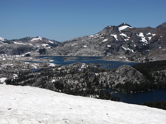
Caples Creek
Follow the Silver Fork Road from Kyburz for approximately 10 miles turning left just before Fitch Rantz Bridge onto a dirt road, which leads Rantz Bridge onto a dirt road, which leads 1/4 mile to the trailhead. The trail follows along the north side of Caples Creek through virgin forest, intersecting the Silver Fork trail and continues through beautiful Jake Schneider’s Meadow intersecting the Old Silver Lake trail. From this junction, the trail proceeds uphill for nearly one mile where it ends at the junction of Government Meadows trail.
Cedar Park Trail
From Highway 50 in Pollock Pines follow the Sly Park Road south for approximately 6 miles to the parking area and trailhead on the left (south) side of the road. This trail contains two small paved loops that total about 1.2 miles in length and are set in a nice stand of pine and conifer trees. The trail system is below 4000 feet in elevation and easily accessed year round. The paved trails and mild grades make it ideal for individuals with disabilities.
Cody Lake
The trailhead is located approximately 7 miles from the small community of Strawberry following the Packsaddle Pass Road from 42 Mile to Section 1, Township 10N, Range 16E. A fairly easy hike leads to this glacier formed lake.
Fleming Meadow Trail System
From Highway 50 in Pollock Pines follow the Sly Park Road south for approximately 4.5 miles to Jenkinson Lake. Turn left just past the lake on Mormon Immigrant Trail (ForestRoute#5). About1milepasttheseconddam turn right onto Blue Gouge Mine Road and follow it 1⁄4 mile to the trailhead. The trailhead is close to the community of Pollock Pines and the elevation of 3,800 feet makes it desirable for early spring and late fall use. The trail system consists of 8.8 miles of dirt roads and trails. The roads have been closed to motor vehicle traffic except by permit. The trails access 1,000 acres of forest and Fleming meadow with abundant wildlife. The area is popular for equestrians, mountain bikes, and hiking with access to Camp Creek.
Government Meadows
Follow the directions given for the Caples Creek Trail to where it intersects with the Government Meadows trail. This short trail leads around several lush green meadows and ends at picturesque Caples Creek.
Lover’s Leap
(a) From Highway 50 (1/4 mile west of Strawberry) turn south at the 42 Mile Picnic Area, cross the bridge and take a right following Packsaddle Pass Road for one mile to the junction with Strawberry Canyon Road. Follow Strawberry Canyon Road for 1/2 mile to the trailhead. The trail leads to the top of Lover’s Leap (a nationally renowned rock climbing area) for a breathtaking view of the South Fork of the American River drainage. The trail continues on for one mile to Camp Sacramento. Only hiking is allowed on the east side of the trail between Lover’s Leap and Camp Sacramento.
(b) Easier Lover’s Leap Trail. Take Highway 50 to the Camp Sacramento turn off. Drive in towards Camp Sacramento and there will be limited parking on the left side of the road. If this lot is full, park in the Mt. Ralston Trailhead parking across Highway 50. To get to the trailhead, walk through the camp past the lodge to the end of the camp. The trail leaves from there through mature forest. The trail goes to the top of Lover’s Leap and is about 1 mile one way and offers a great view of Strawberry 1,000 feet below.
Mount Ralston
Trailhead parking is located across from Camp Sacramento on the north side of Highway 50. The road on the east end of the parking area leads to the trailhead 200 yards away. After the first mile the trail quickly becomes strenuous. Upon reaching the Desolation Wilderness Boundary, it ties into the network of wilderness trails. A magnificent view of Lake Tahoe and the surrounding wilderness can be obtained with a short 1/2 mile hike to the top of Ralston Peak (elev. 9,235). During the summer months be sure to bring along ample drinking water. There are no water sources along the way. A wilderness permit is required if you cross the wilderness boundary.
Old Silver Lake
Follow the directions given for the Caples Creek trail to where it intersects the Old Silver Lake trail at Jake Schneider’s Meadow. After crossing Caples Creek (use caution – no bridge), one can hike through mixed stands of virgin pine and fir. Switchbacks ascend the ridge top to where the trail meets the Silver Fork trail coming in from the southwest.
Pyramid Creek Loop
The trailhead is located on the north side of Highway 50 at Twin Bridges approximately 1/2 mile east of Strawberry. Follow the trail east and then north up to Pyramid Creek and turn right (east) at the sign and follow the trail along the creek. This trail offers beautiful views of the American River canyon, Lovers Leap, waterfalls, and it is an area of special geological interest. Follow the trail north, then loop back south on the old trail bed down the granite slabs and return to Highway 50. The Pyramid Creek Loop trail is located outside of Desolation Wilderness. Note: If you proceed beyond this trail, a wilderness permit is required. To obtain a day use permit self-register at the wilderness boundary.
Sayles Canyon
Follow the directions for the Bryan Meadows Trail to get to the Sayles Canyon/Bryan Meadows trailhead. A moderate climb back and forth across Sayles Creek for approximately 3 1⁄2 miles leads to a beautiful mountain park known as Round Meadows. The trail continues through Round Meadows and ascends one mile to join the Pacific Crest Trail at the ridge crest.
Silver Fork
Follow the directions given for the Caples Creek Trail to where it intersects the Silver Fork trail. The Silver Fork trail begins with a moderate climb. The trail follows along the rapidly descending Silver Creek. The trail levels out and follows the creek past quiet pools and then climbs to the junction of Old Silver Lake trail where the hiker has a splendid view of both Caples Creek and Silver Fork drainages.
Trestle Trail
Follow the Capps Crossing Road from Grizzly Flat or the North South Road (Forest Route #6) to the dirt road 9N36. Turn south on this road and stay to the right for approximately 1⁄2 mile to the trailhead. This pleasant foot- trail follows a railroad grade for 1.2 miles to the site of the main bridge (removed) over Steely Fork Creek. The trail is in excellent condition, and passes three collapsed trestles (wooden railroad bridges) on the steep hillside. Return to the trailhead along the same route.
For more information on hikes on the Highway 50 corridor check out the Forest Service Recreation Opportunity Guides for Non-Motorized Trails. http://www.fs.usda.gov/Internet/FSE_DOCUMENTS/fsbdev7_018779.pdf
PO Box 908, Placerville, CA 95667
(530)303-8344 | infoSPAMFILTER@enfia.org
Quick Links
Explore
PO Box 908, Placerville, CA 95667
(530)303-8344 infoSPAMFILTER@enfia.org